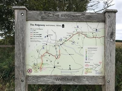
The Ridgeway is an ancient trackway, perhaps 5,000 years old, which is often described as Britain's oldest road. The section clearly identified as an ancient trackway extends from beside the A4 in Wiltshire near Marlborough along the chalk ridge of the to the Thames at the Goring Gap. It is part of the Icknield Way, which ran, not always on the ridge, from Salisbury Plain to East Anglia. The route was adapted and extended as a National Trail, created in 1972. The National Trail is 87 miles (140 km) long.
For at least 5,000 years travellers have used the Ridgeway. The Ridgeway provided a reliable trading route to the Dorset coast and to the Wash. The high dry ground made travel easy and provided a measure of protection by giving traders a commanding view, warning against potential attacks. The Bronze Age saw the construction of the Uffington White Horse and Avebury stone circle. During the Iron age inhabitants took advantage of the high ground by building hillforts along the Ridgeway to help defend the trading route. Following the collapse of Roman power in Britain, invading Germanic settlers and later Viking armies used it. In the middle ages and later, the Ridgeway found use by drovers, moving their livestock from the West Country and Wales to markets in lowland England and London. For most of this time, the Ridgeway existed as an informal series of tracks across the chalk downs, chosen by travellers based on path conditions. Once enclosures started in the 18th century, the current path developed through the building of earth banks and the planting of hedges.
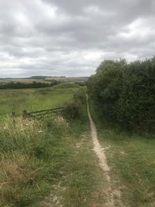
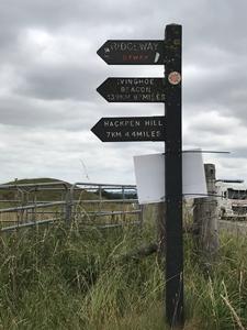
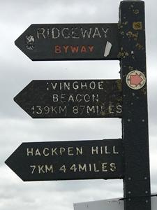
Back in my youth I walked the Ridgeway and loved it. Loads to see and lots to do along the way. These photos were taken at Overton Hill at its southern end when I was visiting Avebury recently.
Thanks to Wikipedia for info.